With reports of serious flooding coming from various parts of Thailand e.g. Sukhothai and Chiang Rai, what might happen if heavy rain falls in the the Ping River catchment upstream of Chiang Mai?
These pictures from 2011 give the answer:


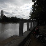
However given similar rains, September 2014 floods could be worse, as levy banks upstream constructed since 2011 will raise water levels, as will this new barrage opposite Chiang Mai’s central market :
Inappropriate construction as reported in July along the Ping River continues.
Comment about the typhoon affecting Chiang Mai waether from Thaivisa.com :
http://www.wunderground.com/wundermap/?lat=20.5&lon=110.2&zoom=6&rad=0&wxsn=0&svr=0&cams=0&sat=0&riv=0&mm=0&hur=1&hur.wr=0&hur.cod=1&hur.fx=1&hur.obs=1&fire=0&ft=0&sl=0
This link is a map tracking Kalmaegi. you can surimpose the satellite imaging by selecting “satellite” in the “layers” menu on the right. it will give you a pretty good idea of the area that can expect downpours from this typhoon